Incident Overview
Description
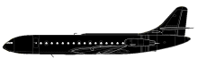
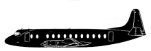
Air Inter flight 696, a Vickers Viscount, impacted a mountain, killing 60 occupants; 8 survived the accident. Flight IT696 departed Lyon for a night time flight to Clermont-Ferrand. It was raining in the area of Clermont-Ferrand, the visibility was around 5 miles with a low 4/8 ceiling at 2300 feet and an overcast at 8000 feet. Near Clermont-Ferrand, the crew had to fly a holding pattern before being cleared to descend to 3600 feet. Then the airplane’s radio compass shifted 180-degrees, probably because electrical discharges in the rainfall blocked the signals of the Clermont-Ferrand (CF) NDB. The crew initiated their descent too early and the Viscount collided with a mountain (Pic du Picon) at 1000 feet, 44 km east of the airport. Cause (translated from French): The accident is a direct result of a collision with the terrain, which occurred at night in stormy conditions near a cold front, while the aircraft was following an apparently normal approach procedure, but shifted eastward by about 30 km. The origin of this accident reveals two anomalies. The first is that the crew was convinced that they were actually over CF when in fact the beacon was more than 30 km away. It seems to be explained only by a strong rotation of the direction finder, whose aberrant character could not be detected by the crew. Still it is necessary to admit moreover that the indications of the direction finder afterwards presented coherent variations with the successive positions of the plane during the double circuit of descent and with the second overflight of the CF beacon. The second anomaly is characterized by the announcement of the beacon overflight by the aircraft, more than three minutes ahead of an estimated eight minutes. This difference may have been overlooked by the crew because of their confidence in the radio compass indication. One can also think that this difference went unnoticed by the crew either because they forgot to check the time or because of a reading error, as the crew had to face a difficult piloting due to turbulence and the presence of a training pilot could also have been a factor of concern and distraction at that time. The work of the commission having made it possible to rule out the hypothesis of a pirate transmitter, the erroneous indication of the radio compass could have resulted either from a defect in the installation of the on-board antenna system associated with certain conditions of the electric field, or more probably from very localized precipitation which accompanied the cold front in the zone of the accident and which could have constituted a kind of transmitter (series of microdischarges) sufficiently powerful to be, during this phase of flight, detected by the aircraft’s radio compass by suffocating the CF field. The interception of the ILS localizer probably strengthened the crew’s conviction. In addition, it is not impossible that the light halo of the city of Thiers, perhaps visible at certain times, may have been an additional motivating factor. Although the instructor pilot had the reputation of attaching great importance to a cross-checking of positions, which was possible in particular by the radial of Moulins, it seems that the crew did not do anything about it. The commission, in definite, admits the possibility of an aberrant indication of a radio compass, but cannot explain the reasons that prevented the crew from correctly controlling the point from which the descent was started and continued.
Primary Cause
Collision with the terrain, likely due to a combination of factors including a deviation in the beacon’s position, an aberrant direction-finding rotation, and an incorrect indication of the radio compass.Collision with the terrain, likely due to a combination of factors including a deviation in the beacon’s position, an aberrant direction-finding rotation, and an incorrect indication of the radio compass.Share on: