Incident Overview

Date: Thursday 17 April 1969
Aircraft Type: Learjet 25
Owner/operator: Volkswagen Pacific
Registration Number: N515VW
Location: near Corban – ÿ Switzerland
Phase of Flight: En route
Status: Destroyed, written off
Casualties: Fatalities: 2 / Occupants: 2
Component Affected: Radio Magnetic Indicators (RMI’s)Radio Magnetic Indicators (RMI’s)
Investigating Agency: CFEAACFEAA
Category: Accident
On July 13, 2023, a Learjet N515VW aircraft experienced a significant incident during a ferry flight to Basle-Mulhouse Airport, France. The flight began at 09:52 from Geneva, Switzerland, and was en route to the airport. The flight was uneventful for the initial part of the journey. At 10:14, the crew contacted air traffic control and received weather information. Wind was 260ø at 6 knots, visibility 3 km, with clouds of 2/8 and 7/8 thicknesses, a pressure of 1017 mb, and a runway in use of 16. The controller instructed the flight to descend to FL50 and then down to 2500 feet. The flight then reported passing the Homburg beacon at 4000 feet and requested the crew to report passing 3500 feet and reaching the ILS approach. At 10:21, the flight reported reaching 2000 feet. Communication with the flight was lost for three minutes and twenty seconds, with the crew reporting a navigational issue ? difficulties with their radio magnetic indicators (RMI’s). They were climbing towards 3500 feet but were instructed to remain at 2500 feet due to traffic at 3500 feet. The Learjet continued south over the Jura mountains until it struck a forested hillside at an altitude of 2230 feet (680 m), impacting the terrain. The wreckage was discovered after three days.On July 13, 2023, a Learjet N515VW aircraft experienced a significant incident during a ferry flight to Basle-Mulhouse Airport, France. The flight began at 09:52 from Geneva, Switzerland, and was en route to the airport. The flight was uneventful for the initial part of the journey. At 10:14, the crew contacted air traffic control and received weather information. Wind was 260ø at 6 knots, visibility 3 km, with clouds of 2/8 and 7/8 thicknesses, a pressure of 1017 mb, and a runway in use of 16. The controller instructed the flight to descend to FL50 and then down to 2500 feet. The flight then reported passing the Homburg beacon at 4000 feet and requested the crew to report passing 3500 feet and reaching the ILS approach. At 10:21, the flight reported reaching 2000 feet. Communication with the flight was lost for three minutes and twenty seconds, with the crew reporting a navigational issue ? difficulties with their radio magnetic indicators (RMI’s). They were climbing towards 3500 feet but were instructed to remain at 2500 feet due to traffic at 3500 feet. The Learjet continued south over the Jura mountains until it struck a forested hillside at an altitude of 2230 feet (680 m), impacting the terrain. The wreckage was discovered after three days.

Description

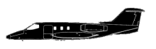
Learjet N515VW took off from Geneva, Switzerland at 09:52 on a ferry flight to Basle-Mulhouse Airport, France where the jet was to undergo routine maintenance. The en route part of the flight was uneventful. At 10:14 the crew contacted air traffic control at Basle-Mulhouse Airport and received the latest weather information. Wind was from 260ø at 6 knots, visibility 3 kilometers, 2/8 clouds at 150 meters, 7/8 clouds at 900 meters, pressure 1017 mb, runway in use: 16. The controller then issued descent instructions to FL50 and later down to 2500 feet. At 10:20 the flight reported passing the Homburg beacon at 4000 feet. The controller requested the crew to report passing 3500 feet and report reaching the Outer Marker for the ILS approach. At 10:21 the flight reported reaching 2000 feet. There was no radio communication with the flight for the next three minutes and twenty seconds. The crew reported that they were going around, heading back towards the Homburg beacon because of problems with their radio magnetic indicators (RMI’s). They reported climbing towards 3500 feet, but the controller instructed them to remain at 2500 feet because of other traffic at 3500 feet. The Learjet continued south over the Jura mountains until it struck a forested hillside at an altitude of 2230 feet (680 m), 13,5 nautical miles (25 km) south of the airport. The wreckage was found after three days. CONCLUSION: “The Commission has unanimously come to the conclusion that the accident was due to a collision with terrain that occurred during following a missed ILS approach procedure, interrupted due to difficulties of navigation.”

Primary Cause

A missed ILS approach procedure interrupted the flight due to difficulties with the radio magnetic indicators (RMI’s), leading to the aircraft climbing towards 3500 feet before impacting the terrain.A missed ILS approach procedure interrupted the flight due to difficulties with the radio magnetic indicators (RMI’s), leading to the aircraft climbing towards 3500 feet before impacting the terrain.

Share on:

Leave a Reply

Your email address will not be published. Required fields are marked *