Incident Overview

Date: Sunday 15 May 1960
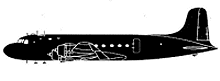
Aircraft Type: Douglas DC-4-1009
Owner/operator: Balair
Registration Number: HB-ILA
Location: near Tora-Tonga – ÿ Sudan
Phase of Flight: En route
Status: Destroyed, written off
Casualties: Fatalities: 12 / Occupants: 12
Component Affected: Aircraft navigation system and position reporting.Aircraft navigation system and position reporting.
Category: Accident
A Balair DC-4 aircraft, operating on a ferry flight from Jeddah, Saudi Arabia to Dakar, Senegal, encountered a slope of the Djebel Marr mountains while cruising at 8000 feet. The aircraft experienced navigational inaccuracies, including a difference of 2-3 degrees between calculated and actual ground speed, and a potential position error of approximately 70 nautical miles to the west and 30 nautical miles to the south. These inaccuracies, combined with an inaccurate position report from 1906Z, resulted in the aircraft deviating from its planned course and ultimately impacting the mountain slope.A Balair DC-4 aircraft, operating on a ferry flight from Jeddah, Saudi Arabia to Dakar, Senegal, encountered a slope of the Djebel Marr mountains while cruising at 8000 feet. The aircraft experienced navigational inaccuracies, including a difference of 2-3 degrees between calculated and actual ground speed, and a potential position error of approximately 70 nautical miles to the west and 30 nautical miles to the south. These inaccuracies, combined with an inaccurate position report from 1906Z, resulted in the aircraft deviating from its planned course and ultimately impacting the mountain slope.

Description

The Balair DC-4 flew into a slope of the Djebel Marr mountains while cruising at 8000 feet. The airplane was operating on a ferry flight from Jeddah, Saudi Arabia to Dakar, Senegal. PROBABLE CAUSE: “1) The fact that the aircraft progressed actually at an average ground speed of at least 200-205kts while the crew believed they were proceeding with no more than 175-178kts as estimated before takeoff. 2) That a slight directional difference of 2 or 3 degrees may have existed between the calculated track and the actual flight path. 3) That these two navigation inaccuracies could build up during a flight of 2,5h and could eventually result in a position error of about 70nm to the west and about 30nm to the south. 4) That for reasons unknown to the Board the position report given for 1906Z and apparently established on the base of an astronomical fix must have been inaccurate and that the crew were, therefore, not able to be conscious of the discrepancies between the dead-reckoning and their actual position. 5) That the aircraft flying at 8000ft hit a slope of the Djebel Marra mountains four minutes before the crew expected to be overhead the El Fasher beacon where they would have begun the climb to 12000ft and when, in their belief the aircraft should have been still more than 60 NM away from these mountains.”

Primary Cause

Nautical inaccuracies and inaccurate position report.Nautical inaccuracies and inaccurate position report.

Share on:

Leave a Reply

Your email address will not be published. Required fields are marked *