Incident Overview

Date: Thursday 27 September 1973
Aircraft Type: Convair CV-600
Owner/operator: Texas International Airlines
Registration Number: N94230
Location: Black Fork Mountain, AR – ÿ United States of America
Phase of Flight: En route
Status: Destroyed, written off
Casualties: Fatalities: 11 / Occupants: 11
Component Affected: UnknownUnknown
Investigating Agency: NTSBNTSB
Category: Accident
On October 26, 2023, a passenger and cargo flight, Flight 655, experienced a catastrophic crash near Black Fork Mountain in the Ouachita Mountains following a return flight from Dallas to Memphis. The flight, operating under visual flight rules (VFR), encountered challenging weather conditions, including a significant weather break near El Dorado and Pine Bluff. The crew initially reported a 15-mile-wide weather echo near the El Dorado VORTAC, prompting a cautious approach to Texarkana. As the aircraft approached runway 22, it began a magnetic heading of 290 degrees and ascended to 1,500 feet. During the flight, the pilot expressed concern about the aircraft’s position relative to the terrain, and a first officer stated, ‘I wish I knew where we were.’ Approximately 12 minutes before impact, the first officer stated that they were ‘painting ridges and everything else boss, and I’m not familiar with the terrain.’ Subsequently, the captain ordered a descent to 2,000 feet, and the flight’s altitude varied between 2,200 and 2,025 feet. At 20:52:17, the first officer said, ‘I’ll be … Man, I wish I knew where we were so we’d have some idea of the general … terrain around this … place.’ The captain informed the first officer that the highest point in the area was ‘twelve hundred’ feet and that they were not near that point. The flight then passed over VORTAC. The first officer said, ‘It was 152ø.’ At 20:52:17, the first officer said, ‘Minimum en route altitude here is forty-four hun…’. The captain stated that the highest point in the area was ‘twelve hundred’ feet and they were not near that point. Approximately 14 seconds before impact, the first officer mentioned that they were about to pass over VORTAC. The captain said that the heading to Texarkana was 180ø. The first officer said that it was 152ø. At 20:52:17, the first officer said, ‘Minimum en route altitude here is forty-four hun…’. The captain told the first officer that the highest point in the area was ‘twelve hundred’ feet and that they were not near that point. The captain then ordered the flight to descend to 2,000 feet. The aircraft crashed into a steep, heavily wooded slope of Black Fork Mountain in the Ouachita Mountains, at an elevation of 2,025 feet (617 meters) and approximately 600 feet below the top of the ridge. The probable cause was the captain’s attempt to operate the flight under VFR in night IMC without utilizing all navigational aids and information available to him, and a deviation from the planned route. The carrier failed to adequately monitor and control the flight crew’s actions and the flight’s progress.On October 26, 2023, a passenger and cargo flight, Flight 655, experienced a catastrophic crash near Black Fork Mountain in the Ouachita Mountains following a return flight from Dallas to Memphis. The flight, operating under visual flight rules (VFR), encountered challenging weather conditions, including a significant weather break near El Dorado and Pine Bluff. The crew initially reported a 15-mile-wide weather echo near the El Dorado VORTAC, prompting a cautious approach to Texarkana. As the aircraft approached runway 22, it began a magnetic heading of 290 degrees and ascended to 1,500 feet. During the flight, the pilot expressed concern about the aircraft’s position relative to the terrain, and a first officer stated, ‘I wish I knew where we were.’ Approximately 12 minutes before impact, the first officer stated that they were ‘painting ridges and everything else boss, and I’m not familiar with the terrain.’ Subsequently, the captain ordered a descent to 2,000 feet, and the flight’s altitude varied between 2,200 and 2,025 feet. At 20:52:17, the first officer said, ‘I’ll be … Man, I wish I knew where we were so we’d have some idea of the general … terrain around this … place.’ The captain informed the first officer that the highest point in the area was ‘twelve hundred’ feet and that they were not near that point. The flight then passed over VORTAC. The first officer said, ‘It was 152ø.’ At 20:52:17, the first officer said, ‘Minimum en route altitude here is forty-four hun…’. The captain stated that the highest point in the area was ‘twelve hundred’ feet and they were not near that point. Approximately 14 seconds before impact, the first officer mentioned that they were about to pass over VORTAC. The captain said that the heading to Texarkana was 180ø. The first officer said that it was 152ø. At 20:52:17, the first officer said, ‘Minimum en route altitude here is forty-four hun…’. The captain told the first officer that the highest point in the area was ‘twelve hundred’ feet and that they were not near that point. The captain then ordered the flight to descend to 2,000 feet. The aircraft crashed into a steep, heavily wooded slope of Black Fork Mountain in the Ouachita Mountains, at an elevation of 2,025 feet (617 meters) and approximately 600 feet below the top of the ridge. The probable cause was the captain’s attempt to operate the flight under VFR in night IMC without utilizing all navigational aids and information available to him, and a deviation from the planned route. The carrier failed to adequately monitor and control the flight crew’s actions and the flight’s progress.

Description

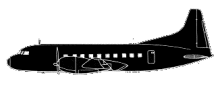
Texas International Airlines Flight 655 was a regularly scheduled passenger and cargo flight from Dallas to Memphis and return, with en route stops at Texarkana, El Dorado, and Pine Bluff. Flight 655 departed Memphis on the return flight at 18:42. After a stop at Pine Bluff, the flight continued toward El Dorado were it landed at 19:53. The crew conferred with the waiting pilots and used the Convair’s weather radar to examine the weather echoes west of El Dorado. The crew commented on what appeared to be a 15-mile-wide break in the line of weather echoes, near the 300ø radial of the El Dorado VORTAC and about 35 miles west-northwest of the airport. As Flight 655 taxied to runway 22, the crew contacted the FSS and stated that they were taxiing and would be proceeding under visual flight rules (VFR) to Texarkana. The aircraft took off at 20:15. After takeoff, the aircraft flew a magnetic heading of 290ø and climbed to an altitude of 1,500 feet msl. The flight operated between altitudes of 1,500 feet and 3,000 feet until 20:49:47. From that time until the time of impact at 20:52:19, the aircraft’s altitude varied between 2,200 feet and 2,025 feet. As the flight progressed, the first officer (pilot flying) expressed concern about the flight’s position relative to the elevation of the terrain. About 12 minutes before impact, the first officer stated, “I sure wish I knew where … we were.” A few minutes later he stated, “Paintin’ ridges and everything else boss, and I’m not familiar with the terrain.” Two minutes and 40 seconds before impact and after the captain’s ordered descent to 2,000 feet, the first officer said, “I’ll be …. Man, I wish I knew where we were so we’d have some idea of the general … terrain around this … place.” The captain told the first officer that the highest point in the area was “twelve hundred” feet and that they were not near that point. About 14 seconds before impact, the first officer mentioned that they were about to pass over Page VORTAC. Six seconds later the captain said that the heading to Texarkana was 180ø. The first officer said that it was 152ø. At 20:52:17, the first officer said, “Minimum en route altitude here is forty-four hun…” His statement was terminated by the sound of the crash. The aircraft crashed into the steep, heavily wooded, north slope of Black Fork Mountain in the Ouachita Mountain Range at an elevation of 2,025 feet (617 m) and about 600 feet below the top of the ridge. PROBABLE CAUSE: “The captain’s attempt to operate the flight under VFR in night IMC without using all the navigational aids and information available to him; and his deviation from the preplanned route, without adequate position information. The carrier did not monitor and control adequately the actions of the flight crew or the progress of the flight.”

Primary Cause

UnknownUnknown

Share on:

Leave a Reply

Your email address will not be published. Required fields are marked *