Incident Overview
Description
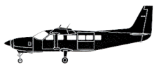
The Alkan Air Cessna 208B aircraft was scheduled to depart Mayo Airport (CYMA), Canada, to conduct 4 flights under visual flight rules (VFR). First a return flight to Rackla Airstrip, then a return flight to Rau Airstrip. The pilot completed the first two flights with no issues. The aircraft departed CYMA on the third flight at 09:54. A portion of the recorded track was along Granite Creek at an altitude of 4200 feet ASL, which put the aircraft 100 to 200 feet above ground level (AGL) at the highest point along Granite Creek. The aircraft was observed flying eastbound along Granite Creek at low altitude and in reduced visibilities due to rain and cloud at about 10:05. The aircraft arrived at Rau Airstrip at 10:17, where the cargo was unloaded and different cargo loaded. A passenger boarded the aircraft for the final flight and was seated in the right seat in the cockpit. The aircraft departed Rau Airstrip at 11:01. The route of the fourth flight from Rau to CYMA was the reverse of the previous flight. The aircraft entered Granite Creek at 4300 feet ASL and was flying at a ground speed of 156 knots. Eyewitnesses at an exploration camp approximately halfway along Granite Creek heard and then observed the aircraft flying at near tree-top level. The cloud bases to the west of the exploration camp were at tree-top level. As it passed the exploration camp, the aircraft turned south into a box canyon, departing from the intended route. It headed toward rising terrain that led to the north face of Mount Albert. The aircraft began to climb and shortly thereafter was observed to disappear into the clouds and fog at 11:12. The aircraft impacted terrain approximately 30 seconds later, in a near wings-level attitude with the flaps in the up position. The 2 occupants were fatally injured on impact. The aircraft was destroyed. Findings as to causes and contributing factors 1. The pilots decision making was influenced by several biases and, as a result, the flight departed and subsequently continued into poor weather conditions in mountainous terrain. 2. The high speed at low altitude and low forward visibility reduced the opportunities for the pilot to take alternative action to avoid terrain. 3. Within the box canyon, the canyon floor elevation increased abruptly within less than 1 NM and the low visibility prevented the pilot from detecting this and taking sufficient actions to prevent collision with terrain. 4. When the pilot turned into the box canyon, the terrain awareness and warning system aural alerts were ineffective in warning the pilot about the rising terrain either because he had already heard multiple similar alerts in the preceding minutes, or because he had silenced the alerts.
Source of Information
https://www.cbc.ca/news/canada/north/alkan-air-aircraft-accident-1.5238183 , https://www.yukon-news.com/news/two-dead-after-plane-crashes-near-mayo/ , https://www.coastreporter.net/two-dead-in-small-plane-crash-in-central-yukon-alkan-air-1.23907829 , https://www.660citynews.com/2019/08/06/two-dead-in-small-plane-crash-in-central-yukon-alkan-air/https://www.cbc.ca/news/canada/north/alkan-air-aircraft-accident-1.5238183 , https://www.yukon-news.com/news/two-dead-after-plane-crashes-near-mayo/ , https://www.coastreporter.net/two-dead-in-small-plane-crash-in-central-yukon-alkan-air-1.23907829 , https://www.660citynews.com/2019/08/06/two-dead-in-small-plane-crash-in-central-yukon-alkan-air/Primary Cause
Pilot bias and adverse weather conditions, specifically mountainous terrain and low visibility, led to a decision to deviate from the planned route and potentially increase the risk of a collision.Pilot bias and adverse weather conditions, specifically mountainous terrain and low visibility, led to a decision to deviate from the planned route and potentially increase the risk of a collision.Share on: