Incident Overview

Description
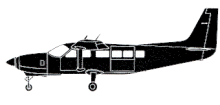
The Cessna departed Wellington (WLG) for a VFR flight at 2000 feet to Koromiko (PCN). While descending for Koromiko Airport the aircraft entered an area of clouds and flew into the heavily wooded eastern slope of Mount Robertson at 1400 feet (430 m) amsl. Causal factors: – The decision by the pilot to descend beneath the cloud layer. – Illusions, created by the conditions, producing misleading visual references. – The pilot’s misidentification of distant terrain features. – An undetected heading error, and loss of “positional awareness”. – Insufficient forward visibility, during the later stages of the descent. – The high speed of the aircraft. – The decision making by the pilot: the delayed decision to descend beneath the cloud layer; continued flight into deteriorating conditions. Contributing / influencing factors: – The pilot’s familiarity with the area, creating a false sense of security. – Improved general weather conditions, causing the pilot to relax. – A possible false horizon, created by a sloping cloud base. – The absence of documented procedures to ensure pilots crossed the coast south of Rarangi.
Primary Cause
Pilot decision-making regarding descent beneath cloud layers, combined with visual illusions, misidentification of terrain, a heading error, and insufficient situational awareness during a descent into deteriorating conditions.Pilot decision-making regarding descent beneath cloud layers, combined with visual illusions, misidentification of terrain, a heading error, and insufficient situational awareness during a descent into deteriorating conditions.Share on:


