Incident Overview
Description
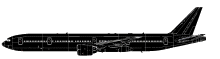
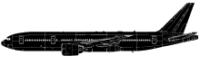
Malaysia Airlines Flight MH370 from Kuala Lumpur, Malaysia to Beijing, China was reported missing on March 8, 2014. There were 227 passengers and 12 crew members on board. The Boeing 777-2H6ER took off from Kuala Lumpur International Airport’s runway 32R at 00:41. At 00:42 the flight was cleared to climb to FL180 and was issued a direct track by Lumpur Approach to the IGARI waypoint. MH370 was then transferred to Lumpur Radar and was cleared to climb to FL250. At 00:50 the flight was further cleared to the planned cruising altitude of FL350. MH370 reported maintaining FL350 at 01:07. Last radio contact was at 01:19 when the Kuala Lumpur Radar controller instructed the flight to contact the radio frequency of Ho Chi Minh Air Traffic Control Centre, Vietnam: “Malaysian Three Seven Zero contact Ho Chi Minh 120 decimal 9 Good Night”. One of the flight crew members replied: “Good night, Malaysian Three Seven Zero.” At 01:21 MH370 was observed on the radar screen of the Kuala Lumpur Radar controller as it passed over waypoint IGARI. Nine seconds later the radar label for MH370 disappeared from the radar screen. The transponder was switched off. At 01:38 Ho Chi Minh ATCC contacted Kuala Lumpur ATCC on the whereabouts of MH370. Kuala Lumpur ATCC contacted the airline’s operations centre, Singapore ACC, Hong Kong ACC, and Phnom Penh ACC, failing to establish the location of MH370. Meanwhile, the airplane flew in a westerly direction back over peninsular Malaysia before turning northwest. Primary radar data showed that the aircraft tracked along the Malacca Strait. During this time the aircraft passed close to waypoints VAMPI, MEKAR, NILAM and possibly IGOGU along a section of airway N571. The final primary radar fix occurred at 02:22. From then on seven handshakes between the aircraft’s SATCOM system and the Inmarsat ground station were recorded. Last satellite data was recorded at 08:11 Malaysian time. Initially search efforts focused on the South China Sea area. On 24 March 2014 further analysis of the Inmarsat satellite data indicated that MH370 flew south and ended its flight in the southern part of the Indian Ocean. A surface search was conducted of probable impact areas along an arc, identified by calculations based on Inmarsat data. The search was carried out from 18 March – 28 April 2014. This search effort was undertaken by an international fleet of aircraft and ships with the search areas over this time progressing generally from an initial southwest location along the arc in a north-easterly direction. No debris associated with MH370 was identified either from the surface search, acoustic search or from the ocean floor search in the vicinity of acoustic detections, which were initially believed to have been from the pingers on the flight recorders. The ocean floor search was completed on 28 May 2014. On June 26 the ATSB published a new search area based on refinements to the analysis of both the flight and satellite data. The priority area of approximately 60,000 km2 extends along the arc for 650 km in a northeast direction from Broken Ridge, an underwater ridge. The width of the priority search area is 93 km. On July 29, 2015 a flapperon washed ashore on the French island of Runion in the Indian Ocean. On August 5 it was established to have been from MH370. The Team is unable to determine the real cause for the disappearance of MH370.
Source of Information
https://www.mh370search.com, http://www.mot.gov.my/en/aviation/air-incident-investigation/MH370, https://cdn.aviation-safety.net/media/Audio_Transcript_MH370_Pilot-ATC_BIT.pdfhttps://www.mh370search.com, http://www.mot.gov.my/en/aviation/air-incident-investigation/MH370, https://cdn.aviation-safety.net/media/Audio_Transcript_MH370_Pilot-ATC_BIT.pdfPrimary Cause
The disappearance of MH370 is currently under investigation, but the initial data suggests a potential malfunction or navigational error during flight, possibly related to a communication failure or a system error. The initial radar data points to a deviation from the planned flight path and a southward trajectory, which could have been triggered by a malfunction.The disappearance of MH370 is currently under investigation, but the initial data suggests a potential malfunction or navigational error during flight, possibly related to a communication failure or a system error. The initial radar data points to a deviation from the planned flight path and a southward trajectory, which could have been triggered by a malfunction.Share on: