Incident Overview

Date: Monday 8 November 1965
Aircraft Type: Boeing 727-23
Owner/operator: American Airlines
Registration Number: N1996
Location: 3 km N of Cincinnati-Greater Cincinnati, OH – ÿ United States of America
Phase of Flight: Approach
Status: Destroyed, written off
Casualties: Fatalities: 58 / Occupants: 62
Component Affected: Radar positioning system (specifically the altimeter)Radar positioning system (specifically the altimeter)
Investigating Agency: CABCAB
Category: Accident
On August 18, 2023, an American Airlines Boeing 727 experienced a catastrophic crash while on approach to Cincinnati Airport, Kentucky. The aircraft, Flight AA383, carrying 58 passengers and crew, crashed after a descent phase, resulting in the loss of all 58 occupants. Radar contact was established with Cincinnati Approach Control, and subsequent descent clearances were issued, leading to the aircraft entering a visual approach. Approximately 18:57, the approach controller directed the flight to descend to 2,000 feet, and the crew acknowledged the clearance. As the flight approached, visibility deteriorated due to rain, and the tower controller reported the rain. At 19:01:14, the tower requested confirmation of the runway, and the crew replied that they were approaching the runway, albeit with an ILS (Instrument Landing System) approach. A 727 was descending at a rate of 2100 feet/min to an altitude of approximately 725 feet, with an airspeed decreasing to 147 knots. The descent rate decreased to 625 ft/min, and the airspeed decreased to 147 knots, culminating in a right wing strike with a tree at approximately 665 feet altitude. The aircraft then slid through scrub trees and ground foilage before impacting, resulting in a significant ground fire. The probable cause was identified as inadequate altimeter monitoring during a visual approach into deteriorating visibility conditions.On August 18, 2023, an American Airlines Boeing 727 experienced a catastrophic crash while on approach to Cincinnati Airport, Kentucky. The aircraft, Flight AA383, carrying 58 passengers and crew, crashed after a descent phase, resulting in the loss of all 58 occupants. Radar contact was established with Cincinnati Approach Control, and subsequent descent clearances were issued, leading to the aircraft entering a visual approach. Approximately 18:57, the approach controller directed the flight to descend to 2,000 feet, and the crew acknowledged the clearance. As the flight approached, visibility deteriorated due to rain, and the tower controller reported the rain. At 19:01:14, the tower requested confirmation of the runway, and the crew replied that they were approaching the runway, albeit with an ILS (Instrument Landing System) approach. A 727 was descending at a rate of 2100 feet/min to an altitude of approximately 725 feet, with an airspeed decreasing to 147 knots. The descent rate decreased to 625 ft/min, and the airspeed decreased to 147 knots, culminating in a right wing strike with a tree at approximately 665 feet altitude. The aircraft then slid through scrub trees and ground foilage before impacting, resulting in a significant ground fire. The probable cause was identified as inadequate altimeter monitoring during a visual approach into deteriorating visibility conditions.

Description

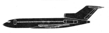
American Airlines flight 383, a Boeing 727, crashed while on approach to Cincinnati Airport, KY, USA, killing 58 occupants; 4 survived the accident. Flight AA383, a Boeing 727, N1996, departed New York-LaGuardia Airport (LGA) at 17:38 for a scheduled flight to the Greater Cincinnati Airport (CVG). It was to be an IFR flight with a requested cruising altitude of 35,000 ft and an estimated time en route of 1 hour 23 minutes. The en route part of the flight was uneventful. About 18:55, when the flight was about 27 miles southeast of the Greater Cincinnati Airport, radar traffic control was effected by Cincinnati Approach Control. Subsequent descent clearances were issued to the flight and at 18:57 flight 383 reported: “…out of five for four and how about a control VFR, we have the airport.” The Approach Controller replied: “… continue to the airport and cleared for a visual approach to runway one eight, precip lying just to the west boundary of the airport and its … southbound.” The crew acknowledged the clearance and the controller cleared the flight to descend to 2,000 feet at their discretion. At 18:58 Approach Control advised the flight that its radar position was six miles southeast of the airport and instructed them to change to the Cincinnati tower frequency. One minute later the tower controller cleared the flight to land. During the approach the visibility at the airport deteriorated as it began to rain. The tower controller reported: “American three eighty three we are beginning to pickup a little rain right now.” At 19:01:14 the tower asked: “American three eighty three you still got the runway Okay?” To which the crew replied “Ah just barely we’ll ah pickup the ILS here”. At this point, thirteen seconds before impact, the 727 was descending at a rate of 2100 feet/min to an altitude of approximately 725 feet (165 ft below published field elevation) with the airspeed holding at 160 knots. The descent rate then decreased to about 625 ft/min for approximately the last 10 seconds of flight with the airspeed decreasing to 147 knots at impact. The right wing struck a tree at an altitude of 665 feet msl which is approximately 225 feet below the published field elevation. The aircraft slid a distance of 340 feet relatively intact through scrub trees and ground foilage before impacting and coming to rest amidst a group of larger trees. Following impact an intense ground fire erupted which completely destroyed the aircraft cabin forward of the tail section. PROBABLE CAUSE: “The failure of the crew to properly monitor the altimeters during a visual approach into deteriorating visibility conditions.”

Primary Cause

Inadequate altimeter monitoring during a visual approach into deteriorating visibility conditions.Inadequate altimeter monitoring during a visual approach into deteriorating visibility conditions.

Share on:

Leave a Reply

Your email address will not be published. Required fields are marked *