Incident Overview
Description
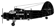
Antonov 2 LY-AVD departed from Budapest at 08:29 for a VFR flight with destination Tunis. According to the flight plan the track would over fly Split, Pescara, the crossing of the Apennines towards Ostia and then onwards its destination, Tunis. The meteorological conditions over the central part of Italy on that March the 9th were characterized by a cold front associated with numerous thunderstorm areas, low cloud coverage over the mountainous Apennines accompanied by icing conditions. After leaving Split, and crossing the Adriatic sea LY-AVD over flew Pescara at 13:20 where the pilot informed the local ATC that the aircraft was inbound Aneda (a reporting point 19 NM East of Monte Rotondo) at a cruising altitude of 5.500 feet (1.676 m). While in vicinity of Pescara, ATC requested and obtained confirmation from LY-AVD that VFR conditions were maintainable. The radio communication ended with the instruction to LY-AVD to contact Rome AIS Centre. There is no record of communication attempt by the crew and it is presumed that the aircraft, soon after that radio communication, impacted with the Monte Rotondo mountain side at an altitude of 6.167 feet (1.880 m) with an estimated ground speed of 115 Kts. DIRECT CAUSES: “Analysis of available evidence make it reasonable to classify the event investigated as an unintentional terrain impact, Controlled Flight Into Terrain (CFIT). At accident time, because of the reduced visibility, incompatible with VFR flying, the crew could not evaluate correctly the orography of the area along there route. It has to be noted that it was not possible to ascertain if adequate maps were available to the crew showing the exact position of ground relief and obstacles. It was not possible to determine if the pilots had flown across the same area in the past. Given the meteorological conditions over the area, the crew did not conform to the Visual Flying Rules that mandated for a track change to maintain the required flight parameters (visibility/clearance from obstacles) and/or a diversion to a suitable alternate airport (as international rules mandate).” CONTRIBUTORY FACTORS: “Analysis of available evidence suggests that the following may be considered as contributory factors to the accident. The prevailing meteorological conditions existing on March 9, 2002 over the flight path of LY-AVD across the central part of Italy did not allow for the flight to be continued under VFR. The Antonov AN2 was not fit for flying in low visibility (IMC) and was not equipped for flying in icing conditions. The pilot of the LY-AVD did not hold the required English language radio-telephony (RT) qualification to operate outside the country of licensing. The pilot of the LY-AVD did not hold an IFR qualification (for flying in IMC).”
Source of Information
https://www.airhistory.net/info/soviet.phphttps://www.airhistory.net/info/soviet.phpPrimary Cause
Unintentional terrain impact, likely due to the combined effects of reduced visibility, icing conditions, and inadequate terrain awareness.Unintentional terrain impact, likely due to the combined effects of reduced visibility, icing conditions, and inadequate terrain awareness.Share on: