Incident Overview

Date: Tuesday 14 June 1960
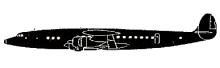
Aircraft Type: Lockheed L-749A Constellation
Owner/operator: Pacific Northern Airlines
Registration Number: N1554V
Location: Mount Gilbert, AK – ÿ United States of America
Phase of Flight: En route
Status: Destroyed, written off
Casualties: Fatalities: 14 / Occupants: 14
Component Affected: Navigation Aids (Amber 1 Airway), Air Defence RadarNavigation Aids (Amber 1 Airway), Air Defence Radar
Investigating Agency: CABCAB
Category: Accident
A Pacific Northern Airlines Flight 201 (PN201) experienced a catastrophic event resulting in a significant loss of aircraft and potential for serious injury. The aircraft deviated from its planned route, entered a hazardous terrain area, and subsequently crashed into the side of Mount Gilbert, resulting in significant damage and loss of life.A Pacific Northern Airlines Flight 201 (PN201) experienced a catastrophic event resulting in a significant loss of aircraft and potential for serious injury. The aircraft deviated from its planned route, entered a hazardous terrain area, and subsequently crashed into the side of Mount Gilbert, resulting in significant damage and loss of life.

Description

Pacific Northern Airlines Flight 201 (PN201), a Lockheed L-749A Constellation, N1554V, departed Seattle/Tacoma International Airport, WA (SEA) at 00:23, for Anchorage International Airport, AK (ANC), with a scheduled stop at Cordova Airport, AK (CDV). The flight from Seattle to Cordova was routine and the flight landed at 03:46. After a quick turnaround the flight taxied out for takeoff on runway 8 at 04:13 and requested clearance to Anchorage. Clearance was issued with an en route altitude of 10,000 feet. The crew reported to Anchorage ARTCC that they passed Hinchinbrook at 04:27, at 9,000 feet on instruments. They were estimating Whittier at 04:47. But the flight never reported passing Whittier. It was found to have flown into the shear face of the 9646 feet high Mount Gilbert at the 9000 feet level. Mount Gilbert was 28nm to the right of the intended track. PROBABLE CAUSE: “The failure of the crew to use all available navigational aids in establishing the aircrafts position on Amber 1 Airway, thereby allowing the aircraft to deviate from course and fly over hazardous terrain. A contributing factor was the failure of Air Defence Radar, which had been tracking the aircraft, to notify either ARTCC or the crew that the aircraft was proceeding on a dangerous course.”

Primary Cause

Failure to utilize all available navigational aids, leading to deviation from the planned flight path and subsequent impact with Mount Gilbert.Failure to utilize all available navigational aids, leading to deviation from the planned flight path and subsequent impact with Mount Gilbert.

Share on:

Leave a Reply

Your email address will not be published. Required fields are marked *