Incident Overview

Date: Saturday 2 March 1957
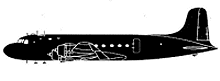
Aircraft Type: Douglas C-54B-20-DO (DC-4)
Owner/operator: Alaska Airlines
Registration Number: N90449
Location: 6 km W of Blyn, WA – ÿ United States of America
Phase of Flight: En route
Status: Destroyed, written off
Casualties: Fatalities: 5 / Occupants: 5
Component Affected: Aircraft instrumentation (instruments) and wing.Aircraft instrumentation (instruments) and wing.
Investigating Agency: CABCAB
Category: Accident
Alaska Airlines Flight 100 experienced a significant incident on its flight from Seattle to Fairbanks. The aircraft entered an overcast and subsequently deviated to VFR operations, eventually impacting trees and sustaining significant damage. The incident involved instrument failure, co-pilot instrument removal, and potential vandalism.Alaska Airlines Flight 100 experienced a significant incident on its flight from Seattle to Fairbanks. The aircraft entered an overcast and subsequently deviated to VFR operations, eventually impacting trees and sustaining significant damage. The incident involved instrument failure, co-pilot instrument removal, and potential vandalism.

Description

Alaska Airlines Flight 100 had arrived at Fairbanks from Seattle at 07:17 and was to fly back a little later. An IFR flight plan was filed with en route altitudes of 9500 to 12000 feet. The aircraft took off at 09:58 in VFR weather conditions. After following the Amber 2 airway at 10000 feet, the aircraft climbed to 12000 feet following the Blue airway. At 12:40 while over Haines, the crew cancelled their instrument flight plan and informed ARTC that it would proceed VFR to Annette and would file DVFR (Defence VFR) after Annette and before entering the CADIZ (Canadian Air Defence Identification Zone). Thereafter Flight 100 proceeded reporting positions as DVFR at 1000 feet. Last radio contact with the flight was at 17:17 when it reported its position near Dungeness in VFR. Eyewitnesses in the area saw the aircraft beneath the overcast at 1000-1500 feet heading for foothills, the tops (2100 feet) of which were obscured by the clouds. The aircraft struck trees and cut a swath in the steeply rising wooded slope. The wings broke off and a fire erupted. The wreckage was located one day after the accident, but could not be reached before March 6, due to adverse weather and inaccessibility of the location. The investigators found out that the co-pilots instruments had been removed from the relatively undamaged panel and stolen by vandals. PROBABLE CAUSE: “Navigational error and poor judgement exhibited by the pilot in entering an overcast in a mountainous area at a dangerously low altitude.”

Primary Cause

Navigational error and poor judgement exhibited by the pilot in entering an overcast in a mountainous area at a dangerously low altitude.Navigational error and poor judgement exhibited by the pilot in entering an overcast in a mountainous area at a dangerously low altitude.

Share on:

Leave a Reply

Your email address will not be published. Required fields are marked *