Incident Overview
Description
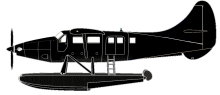
A DHC-3T Vazar Turbine Otter float plane impacted rocky, mountainous, rising terrain of Mount Jumbo on Prince of Wales Island in Alaska, USA in low cloud conditions. The aircraft sustained substantial damage. Of the 11 occupants on board, the pilot was uninjured, four passengers sustained minor injuries, and six passengers sustained serious injuries. The float plane had departed Steamboat Bay Seaplane Base about 07:47 and was headed for Ketchikan, Alaska. The area between Steamboat Bay and Ketchikan consists of remote inland fjords, coastal waterways, and steep mountainous terrain. The accident pilot reported to the NTSB that while in level cruise flight at about 1,100 ft mean sea level (MSL), and as the flight progressed into an area known as Sulzer Portage, visibility decreased rapidly from about 3-5 miles to nil. In an attempt to turnaround and return to VFR conditions, he initiated a climbing right turn. Prior to completing the 180ø right turn, he saw what he believed to be a body of water and he became momentarily disoriented, so he leveled the wings. Shortly thereafter, he realized that the airplane was approaching an area of snow-covered mountainous terrain, so he applied full power and initiated a steep, emergency climb to avoid rising terrain ahead. As the steep emergency climb continued, the airspeed decayed, and the airplane subsequently collided with an area of rocky, rising terrain. During the initial impact, the airplane’s floats were sheared off. The airplane wreckage came to rest in an area known as Jumbo Mountain, sustaining substantial damage to wings and fuselage. The pilot stated that the Terrain Awareness and Warning System (TAWS) was in the inhibit mode at the time of the accident. A “First Alert” was received from the accident airplane’s onboard emergency locator transmitter (ELT) at 09:11. About the same time, 911 dispatch in Ketchikan talked to a survivor who provided GPS position and elevation based on data from her iPhone. At 10:47 two US Coast Guard helicopters arrived in the search area and one helicopter obtained a weak direction finding (DF) bearing from the ELT at the crash scene. The DF bearing, and the survivor’s description of the accident area were used to direct search assets in close proximity to the accident site, so the survivors could hear the USCG helicopters. Two-way radio communications were established between the survivors and USCG by utilizing the accident airplane’s radio. The USCG located the accident site at 11:56. At 13:08 all 11 survivors had been hoisted into the USCG’s rescue helicopter and transferred to the staging area for transport back to Ketchikan,. The accident site was located on a rock face on the east side of Jumbo Mountain at an elevation of about 2,557 ft msl. All the airplane major components were located at the accident site. Probable cause: “The pilot’s decision to continue the visual flight rules flight into instrument meteorological conditions, which resulted in controlled flight into terrain.”
Source of Information
http://www.ktva.com/story/38612874/plane-crashes-near-ketchikan-with-11-aboard, http://www.sitnews.us/0718News/071018/071018_rescue.htmlhttp://www.ktva.com/story/38612874/plane-crashes-near-ketchikan-with-11-aboard, http://www.sitnews.us/0718News/071018/071018_rescue.htmlPrimary Cause
Pilot’s decision to continue a visual flight rules flight into IMC despite deteriorating visibility and a change in flight path, resulting in a controlled flight into terrain.Pilot’s decision to continue a visual flight rules flight into IMC despite deteriorating visibility and a change in flight path, resulting in a controlled flight into terrain.Share on: