Incident Overview
Description
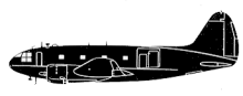
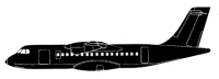
An ATR-42-300 operating Santa B rbara Airlines Flight 518 was destroyed when it impacted the side of a mountain shortly after takeoff from Mrida-A Carnevalli Airport in Venezuela. All 46 on board were killed. Mrida Airport is located in a mountain valley at an elevation of 5010 feet. Terrain in the valley rises from 1000 to 19.500 feet. Arrivals and departures have to use the Rio Chama corridor to the west of the airport. Runway 07 is used for landings and takeoffs have to be performed in the opposite direction, from runway 25. Santa B rbara Airlines however used an unpublished approach and departure procedure which let the aircraft use a valley to the northeast of the airport. This procedure saved about 15 minutes of flying time on the route to Caracas. After all passengers had boarded for flight 518 to Caracas, it took about 30 minutes for the pilots to arrive at the aircraft. Being late, they immediately started the engines while simultaneously asking for permission to do so. Because an Avior Airlines flight was approaching the airport, the crew were told to expedite their departure or wait for the arrival of the Avior aircraft. The flight crew decided to go and began taxiing 2 minutes and 40 seconds after startup. Consequently the AHRS (attitude and heading reference) system of the airplane was unusable. The aircraft needed to remain still for 3 minutes after the battery is turned on so that all gyroscopes, accelerometers and magnetometers can be stabilized and synchronized. The AHRS provides attitude information for aircraft, including roll, pitch and yaw. The captain possibly expected to re-initialize the system while they were at cruising altitude. After departure from runway 25 the crew planned to use the unpublished procedure. Climbing through clouds a 180-degree turn was initiated. Using the unreliable magnetic compass, the flight made a 270 degree turn, heading towards rising terrain. The captain took over control from the copilot. When visual contact with terrain was regained, the crew noted they were heading for mountains. The captain tried to avoid rising terrain but the aircraft impacted the side of a mountain at 3810 m. CONCLUSIONS The attitude and heading reference system (AHRS) as a device was operational, however the initialization of the system was incomplete, so the standard mode was in a fault condition. This failure mode left the RMI or radio magnetic indicators and the autopilot inoperative. The EGPWS or enhanced ground proximity warning system was inoperative in the “enhanced” functions, since the information is displayed on the EFIS system screens, therefore there was no early warning (Visual) of impact against the mountain range. The GPS was the only instrument capable of providing heading information to within one degree of accuracy. Because it is located on the co-pilot’s lower left panel, the information provided by the co-pilot was basically available for co-pilot observation. In addition, the size of the display is relatively small for the information it shows. The crew was valid, qualified and certified by the National Institute of Civil Aeronautics (INAC). However, the crew was very unconcerned to learn that they were taking off with the AHRS system inoperative and the weather conditions were instrument or IMC. The meteorological station in Merida was inoperative. The control tower did not have an operational communications recording system. According to the deformation shown on the low pressure compressor wheels, the engines had power at the time of impact.
Source of Information
https://www.lagad-aviation.com/es/publicaciones/Analisis_Vuelo_518_de_Santa_Barbara_Airlines.phphttps://www.lagad-aviation.com/es/publicaciones/Analisis_Vuelo_518_de_Santa_Barbara_Airlines.phpPrimary Cause
Incomplete initialization of the AHRS system, leading to a fault condition that rendered the system unusable and resulted in loss of critical navigation data.Incomplete initialization of the AHRS system, leading to a fault condition that rendered the system unusable and resulted in loss of critical navigation data.Share on: