Incident Overview

Date: Friday 26 September 1997
Aircraft Type: Airbus A300B4-220
Owner/operator: Garuda Indonesia Airways
Registration Number: PK-GAI
Location: 25 km SSW of Medan-Polonia Airport (MES) – ÿ Indonesia
Phase of Flight: Approach
Status: Destroyed, written off
Casualties: Fatalities: 234 / Occupants: 234
Component Affected: Aircraft Flight Control System (specifically, the radar vectoring system)Aircraft Flight Control System (specifically, the radar vectoring system)
Investigating Agency: NTSCNTSC
Category: Accident
Garuda Indonesia Airways flight 152 experienced a catastrophic loss of life after impacting terrain near Medan, Indonesia, resulting in the destruction of the aircraft. The flight, an Airbus A300B4-220, was cleared for an ILS approach to Medan’s runway 05 and was flying on a 316-degree heading on Airway 585/W12. Upon descending to 3000 feet, the crew was instructed to turn left, heading 240 degrees for vectoring to intercept the runway 05 ILS. However, the crew failed to respond to this instruction, leading to a confusing communication between the flight crew and the controller. The controller addressed the call to ‘Merpati 152’, which the flight crew repeated, using the correct call sign. The flight crew then replied, ‘GIA 152 heading 235. Confirm we cleared from a mountainous area?’ At 13:28, the controller confirmed the flight was turning towards a mountainous area and instructed the flight to continue on a 215-degree heading. At 13:30, ATC directed the flight to turn right heading 046 and report when established on the localizer. Despite being correctly instructed to turn left, the flight crew?s confusion led to a deviation from the planned turn. The controller, potentially recognizing the error, stated, ‘152 OK, you continue turning left now.’ This continued left turn, despite the crew?s expectation of a right turn, caused the aircraft to impact a wooded area, break up, and burst into flames. The wreckage spread over a 150×75 square meter area near Pancur Batu, Indonesia, resulting in significant smoke and smog. The probable cause was a combination of radar vectoring errors, which resulted in the aircraft descending below its assigned altitude and impacting treetops. This reduced the aircraft?s vertical awareness, leading to a catastrophic descent and subsequent fire.Garuda Indonesia Airways flight 152 experienced a catastrophic loss of life after impacting terrain near Medan, Indonesia, resulting in the destruction of the aircraft. The flight, an Airbus A300B4-220, was cleared for an ILS approach to Medan’s runway 05 and was flying on a 316-degree heading on Airway 585/W12. Upon descending to 3000 feet, the crew was instructed to turn left, heading 240 degrees for vectoring to intercept the runway 05 ILS. However, the crew failed to respond to this instruction, leading to a confusing communication between the flight crew and the controller. The controller addressed the call to ‘Merpati 152’, which the flight crew repeated, using the correct call sign. The flight crew then replied, ‘GIA 152 heading 235. Confirm we cleared from a mountainous area?’ At 13:28, the controller confirmed the flight was turning towards a mountainous area and instructed the flight to continue on a 215-degree heading. At 13:30, ATC directed the flight to turn right heading 046 and report when established on the localizer. Despite being correctly instructed to turn left, the flight crew?s confusion led to a deviation from the planned turn. The controller, potentially recognizing the error, stated, ‘152 OK, you continue turning left now.’ This continued left turn, despite the crew?s expectation of a right turn, caused the aircraft to impact a wooded area, break up, and burst into flames. The wreckage spread over a 150×75 square meter area near Pancur Batu, Indonesia, resulting in significant smoke and smog. The probable cause was a combination of radar vectoring errors, which resulted in the aircraft descending below its assigned altitude and impacting treetops. This reduced the aircraft?s vertical awareness, leading to a catastrophic descent and subsequent fire.

Description

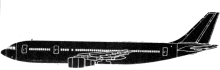
Garuda Indonesia Airways flight 152 from Jakarta to Medan, Indonesia, was destroyed after impacting terrain near Medan. All 234 occupants suffered fatal injuries. The aircraft, an Airbus A300B4-220, was cleared for an ILS approach to Medan’s runway 05 and was flying on a 316 degree heading on Airway 585/W12. Having descended to 3000 feet the crew were instructed to turn left, heading 240 degrees for vectoring to intercept the runway 05 ILS. The flight crew did not respond to this instruction, as the controller addressed the call to ‘Merpati 152’. The instructions were repeated, this time using the correct call sign. The flight crew replied: “GIA 152 heading 235. Confirm we cleared from a (pause) mountainous area?” At 13:28 the controller confirmed they were turning towards a mountainous area and the flight was instructed to continue on a 215 degree heading. At 13:30 ATC directed the flight to turn right heading 046 and report when established on the localizer. Although the clearance for a right hand turn had been read back correctly, confusion on the part of the air traffic controller followed over whether GA152 was turning left or right: “152, confirm you’re making turning left now?” Garuda 152 responded, as cleared, that they were turning right. The controller subsequently added to the confusion by stating: “152 OK, you continue turning left now.” This was contrary to the crew’s expectations, so they enquired: “A (pause) confirm turning left? We are starting turning right now.” The controller, possibly realising his error, replied: “OK (pause). OK….. GIA 152 continue turn right heading 015.” Ten seconds later, the Airbus impacted a wooded area, broke up and burst into flames. The wreckage covered a 150×75 m area near the village of Pancur Batu, which is located at 900-1000 meters amsl. The region was affected by smog from forest fires; visibility was reported to be 600-800 meters. Probable Cause: “There was confusion regarding turning direction of left turn instead of right turn at critical position during radar vectoring that reduced the flight crew’s vertical awareness while they were concentrating on the aircraft’s lateral changes. These caused the aircraft to continue descending below the assigned altitude of 2000 ft and hit treetops at 1550 ft above mean sea level.”

Source of Information

https://aviation-safety.net/investigation/cvr/transcripts/atc_ga152.phphttps://aviation-safety.net/investigation/cvr/transcripts/atc_ga152.php

Primary Cause

Radar vectoring errors during critical position during radar vectoring reduced the flight crew’s vertical awareness, causing the aircraft to descend below its assigned altitude and impact treetops.Radar vectoring errors during critical position during radar vectoring reduced the flight crew’s vertical awareness, causing the aircraft to descend below its assigned altitude and impact treetops.

Share on:

Leave a Reply

Your email address will not be published. Required fields are marked *