Incident Overview
Description
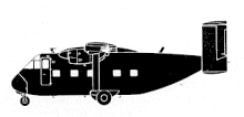
The Shorts Skyvan aircraft, VH-PNI, was scheduled to carry out two return charter flights from Minj to Mendi. The flight plan showed that these were to be instrument flight rules (IFR) category flights but specified that visual flight rules (VFR) procedures would be used throughout. The first flight from Minj to Mendi, which was the one on which the accident occurred, was planned with a position report abeam Mt. Hagen 9 minutes after departure and with a further 17 minute time interval between Mt. Hagen and Mendi. The planned cruising heights on these two route sectors were 8,500 and 10,000 feet respectively and the tracks were 277 degrees magnetic and 245 degrees magnetic. These tracks do not take into consideration the deviations from track which are necessary to avoid the high en route terrain; the most significant being Mount Giluwe which is 14,346 feet (4373 m) in height and lies on the direct track between Mt. Hagen and Mendi. To avoid Mt. Giluwe when operating on this route at heights below the lowest safe altitude of 16,800 feet, it is necessary for aircraft to divert to the north via the Tomba Pass or to the south via the Kuta Pass. The aircraft departed from Minj at 10:11 hours. The was offered the choice of tracking via the Tomba or the Kuta Pass and accepted the Tomba. The pilot made the necessary position reports and passed Mt. Hagen at 10,000 feet at 10:23 hours. At 10:28 hours VH-PNI reported on the Madang frequency and two minutes later Madang passed traffic information to VH-PNI and a following aircraft. The pilot of VH-PNI acknowledged this information and amended his estimated time of arrival at Mendi to 10:38 hours. At 10:35 hours Madang passed further traffic information to a number of aircraft in the area, including VH-PNI, but there was no acknowledgement from VH-PNI and the aircraft failed to arrive at Mendi. The wreckage of the aircraft was sighted from the air on the morning of 2 September on the north-eastern slope of Mt. Giluwe, at an altitude of 10,250 feet (3124 m), close to the direct track from Mt. Hagen to Mendi. It had impacted a steep, heavily timbered slope and broke up. Over the Tomba Pass there was a strato-cumulus cloud layer between 10000 and 10300 feet and unlimited visibility above. Cause: “The cause of the accident has not been determined.”
Primary Cause
Mountain Giluwe obstruction ? The primary cause was the unexpected and significant obstruction of the flight path by Mount Giluwe, requiring the pilot to divert to the Tomba Pass or Kuta Pass.Mountain Giluwe obstruction ? The primary cause was the unexpected and significant obstruction of the flight path by Mount Giluwe, requiring the pilot to divert to the Tomba Pass or Kuta Pass.Share on: