Incident Overview

Date: Monday 23 December 2002
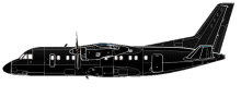
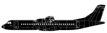
Aircraft Type: Antonov An-140
Owner/operator: Aeromist Kharkiv
Registration Number: UR-14003
Location: near Baghrabad – ÿ Iran
Phase of Flight: En route
Status: Destroyed, written off
Casualties: Fatalities: 44 / Occupants: 44
Component Affected: Cockpit Global Positioning System (GPS) ? specifically, the pilot’s incorrect use of the system.Cockpit Global Positioning System (GPS) ? specifically, the pilot’s incorrect use of the system.
Category: Accident
An Antonov 140 aircraft carrying aerospace scientists and executives traveled from Kharkov, Iran, to Trabzon, Turkey, for a test flight of the Iran-140. The flight landed at Trabzon after refueling and then continued towards Isfahan, Iran. During descent, it collided with a mountain, resulting in a crash.An Antonov 140 aircraft carrying aerospace scientists and executives traveled from Kharkov, Iran, to Trabzon, Turkey, for a test flight of the Iran-140. The flight landed at Trabzon after refueling and then continued towards Isfahan, Iran. During descent, it collided with a mountain, resulting in a crash.

Description

The Antonov 140 departed Kharkov at 11:23 for a flight to Isfahan, Iran via Trabzon. The passengers, aerospace scientists and executives, were to visit the test flight of the Iran-140, an Antonov 140 built under license in Iran. At 13:45 the flight landed at Trabzon, Turkey for refueling. About one hour later, at 14:51, the plane took off heading for Isfahan. While descending towards Isfahan in an area of poor visibility, the aircraft collided with a mountain. Iran’s civil aviation authority announced that a pilot’s failure to correctly use a cockpit global positioning system (GPS) caused the crash.

Source of Information

https://www.airhistory.net/info/soviet.phphttps://www.airhistory.net/info/soviet.php

Primary Cause

Pilot error in using a cockpit global positioning system (GPS) to accurately determine altitude and position.Pilot error in using a cockpit global positioning system (GPS) to accurately determine altitude and position.

Share on:

Leave a Reply

Your email address will not be published. Required fields are marked *