Flight Information

  • Operator: Clay Lacy Aviation opb Vici Aviation LLC
  • Aircraft Type: Hawker 900XP
  • Registration: N900VA
  • Departure Airport: Grand Junction Regional Airport, CO (GJT/KGJT)
  • Destination Airport: Tacoma Narrows Airport, WA (TIW/KTIW)

Incident Overview

  • Date: Wednesday, February 7, 2024
  • Time: 10:48
  • Location: Near Westwater, Utah, United States
  • Flight Phase: Manoeuvring
  • Nature: Ferry/positioning
  • Occupants: 2 (2 fatalities, 0 survivors)

Aircraft Details

  • Manufacturer Serial Number (MSN): HA-0020
  • Year of Manufacture: 2007
  • Engine Model: Honeywell TFE731-50R

On February 7, 2024, about 1048 mountain standard time, a Hawker 900XP, N900VA, was destroyed when it was involved in an accident near Westwater, Utah. The captain and co-pilot were fatally injured. The airplane was operated as a Title 14 Code of Federal Regulations Part 91 positioning flight.

The airplane, which was operated by Vici Aviation, LLC and managed by Clay Lacy Aviation, Inc., arrived at West Star Aviation’s facility at Grand Junction Regional Airport (GJT), Grand Junction, Colorado on December 20, 2023 for routine maintenance. According to preliminary information from the maintenance facility, multiple routine inspections had been completed on the airplane including a requirement to remove the wing leading edges and TKS panels to inspect for cracks and signs of corrosion. After the inspections were completed, the airplane was returned to service on February 6, 2024.

The flight crew had planned to fly the airplane from GJT to Gig Harbor, Washington on the day of the accident, during which time they would perform a stall warning and systems check in accordance with the airframe manufacturer’s requirements. These requirements, which were listed in the pilot’s operating manual, included a required altitude above 10,000 ft above ground level, 10,000 ft above clouds and below 18,000 ft mean sea level. In addition, this check flight could only be conducted during day visual meteorological conditions with a good visual horizon, with the autopilot disengaged, an operative stall identification system, the external surfaces free of ice, the ventral tank empty and weather radar on standby.

According to preliminary automatic dependent system broadcast (ADS-B) data, the airplane departed GJT at 1037 and entered a climb on a southeast heading. The flight crew asked air traffic control (ATC) for a block of altitude from FL180 to FL200 and ATC approved the request. The airplane circled to the northwest as it continued to climb and subsequently leveled off at 1043:49, near the top of the altitude block. At 1046:47 the flight track data showed the airplane begin a rapid descent in circular pattern that resembled the shape of a corkscrew. The airplane made multiple rotations before the track ceased at 1047:44.

The airplane came to rest in flat open terrain about 25 nm northwest of GJT at an elevation of about 4,800 ft mean sea level and oriented on a west heading. The airplane’s major structures were all accounted for at the accident site. A debris path was traced from the main wreckage to the end of a burn area that was about 200 ft long and 175 ft wide at the widest point, oriented on a magnetic heading of 345°. A silhouette of the left wing, fuselage and both engines was located about 10 ft south of the main wreckage.

The airplane’s flight data recorder and cockpit voice recorder were both recovered from the accident site. The wreckage has also been retained for further examination.

Cause of Crash

  • Primary Cause: Under investigation
  • Investigating Agency: NTSB

Investigation Status

  • Investigating Agency: NTSB
  • Confidence Rating: Information verified through data from accident investigation authorities

Supporting Information

METAR:
Weather at the departure airport about the departure (1737Z) and accident time (1747Z):
KGJT 071753Z 35008KT 10SM -RA BKN037 OVC055 07/02 A2959 RMK AO2 RAE08B26 SLP994 P0000 60001 T00670017 10083 20044 51013
KGJT 071653Z 17009KT 10SM -RA BKN047 OVC085 07/00 A2957 RMK AO2 RAB37 SLP988 P0001 T00720000
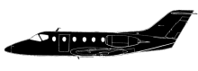
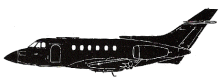
Accident investigation:
cover
Investigating agency: NTSB
Report number: WPR24FA083
Status: Preliminary report
Duration:
Download report:  Preliminary report
Sources:

Share on:

Leave a Reply

Your email address will not be published. Required fields are marked *

Related Crashes